Return to Map Specimen Database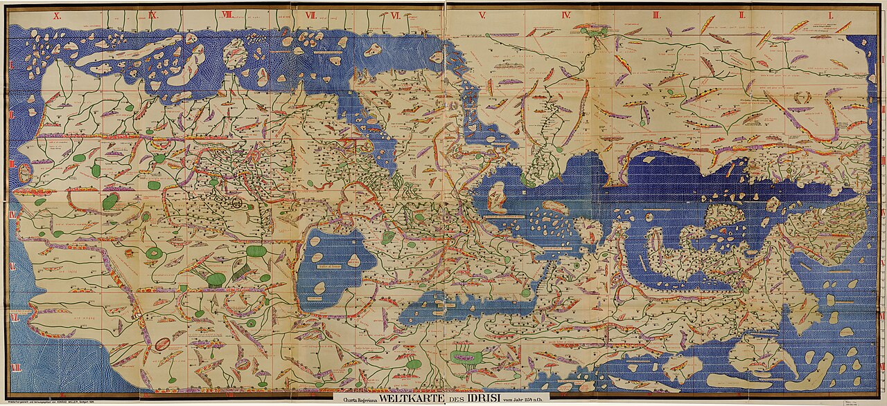
Era: Ancient & Medieval·Cartographer: Muhammad Al-Idrisi·Year: 1154·Public Domain
Al-Idrisi’s Tabula Rogeriana (Nuzhat al-Mushtaq)
"The medieval Islamic masterwork created for King Roger II of Sicily, drawn South-Up"
Created over 15 years in Palermo by Arab scholar Al-Idrisi for the Norman Christian King Roger II, this 70-sheet atlas combined Islamic maritime knowledge, Ptolemaic coordinates, and interviews with Mediterranean sailors into the most accurate map of the Middle Ages.
Interactive Specimen Pan & ZoomAccession: MS. Pococke 375
Orientation: South-Up
2,000 × 1,000 mm (assembled silver planisphere)
Muhammad Al-Idrisi·1154·Bodleian Library, Oxford
ZOOM: 100%Repository Archive
Notable Cartographic Signatures
- South-Up orientation with Mecca and the Islamic world situated above Europe
- Detailed Nile river basin with Lake Victoria-like source lakes
- Detailed Mediterranean coastlines with hundreds of port towns
The Rhetorical & Ideological Argument
"A triumph of multicultural scientific synthesis: proving that Arab and European geographical knowledge could unite to represent the habitable globe with South at the top."
Explicit Features
- South-Up orientation with Mecca and the Islamic world situated above Europe
- Detailed Nile river basin with Lake Victoria-like source lakes
- Detailed Mediterranean coastlines with hundreds of port towns
Intentional Omissions
- Southern African cape (depicted as curling eastward into Asia)
Physical Specimen & Geodesy
Projection:
Equirectangular / Conic Hybrid
Orientation Axis:
South-Up
Physical Medium:
Ink and gold illumination on paper (70 sectional sheets)
Original Physical Dimensions:
2,000 × 1,000 mm (assembled silver planisphere)
Custodial Repository:
Bodleian Library, Oxford
Accession: MS. Pococke 375
Interdisciplinary Context & Connections
NarratologiumMANIFESTS
South-Up Decentering of Europe
ChromologiumUTILIZES
Islamic Gold & Lapis Illumination Ramps
Academic Provenance: Al-Idrisi, M. (1154)