Return to Map Specimen Database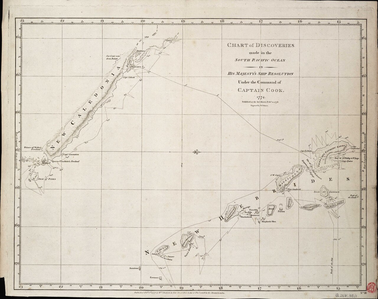
Era: Age of Discovery & Imperial·Cartographer: Captain James Cook (HMS Resolution)·Year: 1774·Public Domain
Captain Cook’s Chart of the Discoveries in the South Pacific Ocean (1774)
"The chart that introduced Sandy Island and mapped New Caledonia and the New Hebrides"
Constructed during Cook's second Pacific voyage on HMS Resolution, this chart mapped New Caledonia, Norfolk Island, and the Coral Sea, while inserting 'Sandy I.' at 19°15'S—initiating a 236-year cartographic phantom.
Interactive Specimen Pan & ZoomAccession: Add MS 15500
Orientation: North-Up
680 × 520 mm
Captain James Cook (HMS Resolution)·1774·British Hydrographic Office / British Library
ZOOM: 100%Repository Archive
Notable Cartographic Signatures
- First charting of Sandy Island (Île de Sable)
- Detailed track of HMS Resolution with sounding depth notations
- Accurate longitude measurements made using the Larcum Kendall K1 chronometer
The Rhetorical & Ideological Argument
"A declaration of British hydrographic supremacy in the Pacific, charting safe channels for naval and commercial expansion."
Explicit Features
- First charting of Sandy Island (Île de Sable)
- Detailed track of HMS Resolution with sounding depth notations
- Accurate longitude measurements made using the Larcum Kendall K1 chronometer
Intentional Omissions
- The Great Barrier Reef's full labyrinthine complexity
Physical Specimen & Geodesy
Projection:
Mercator Marine Chart
Orientation Axis:
North-Up
Physical Medium:
Engraved hydrographic chart on laid paper
Original Physical Dimensions:
680 × 520 mm
Custodial Repository:
British Hydrographic Office / British Library
Accession: Add MS 15500
Interdisciplinary Context & Connections
LunologiumUSES
Marine Chronometer Longitude Fixes
CartologiumORIGINATES
Sandy Island Phantom Creation
Academic Provenance: Cook, J. (1777)