Return to Map Specimen Database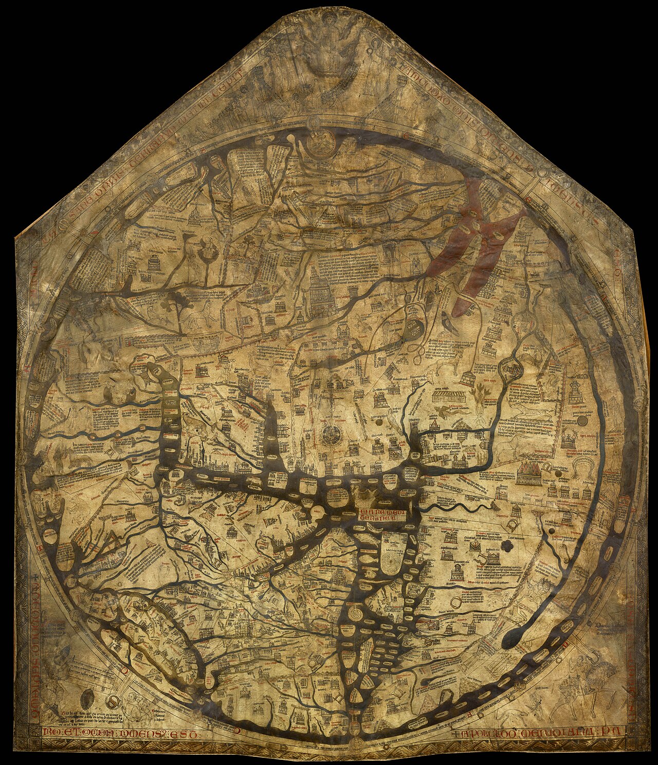
Era: Ancient & Medieval·Cartographer: Richard of Holdingham (Richard de Bello)·Year: 1300·Public Domain
Hereford Mappa Mundi
"The largest surviving medieval world map, placing Jerusalem at the center and Christ at the summit"
A monumental encyclopedia of medieval Christian cosmology, depicting over 420 cities, 15 biblical battles, 33 plants and animals, and 32 monstrous human races along the southern periphery of Africa.
Interactive Specimen Pan & ZoomAccession: Hereford Mappa Mundi Archive
Orientation: East-Up
1,580 × 1,330 mm
Richard of Holdingham (Richard de Bello)·1300·Hereford Cathedral, England
ZOOM: 100%Repository Archive
Notable Cartographic Signatures
- Jerusalem positioned as the exact geometric navel (umbilicus mundi)
- Garden of Eden at the top (East) surrounded by flaming walls
- Tower of Babel, Red Sea crossing, and Noah's Ark clearly illustrated
- Blemmyae (headless men) and Sciapods (one-legged shade-makers) on the edges
The Rhetorical & Ideological Argument
"The map is not a tool for physical wayfinding, but a spiritual pilgrimage: the Earth is the stage of human salvation, oriented toward Paradise in the East with Christ judging humanity at the cosmic summit."
Explicit Features
- Jerusalem positioned as the exact geometric navel (umbilicus mundi)
- Garden of Eden at the top (East) surrounded by flaming walls
- Tower of Babel, Red Sea crossing, and Noah's Ark clearly illustrated
- Blemmyae (headless men) and Sciapods (one-legged shade-makers) on the edges
Intentional Omissions
- Accurate metric distances; geography is bent to serve biblical exegesis
Physical Specimen & Geodesy
Projection:
Theological T-O Mappa Mundi
Orientation Axis:
East-Up
Physical Medium:
Single skin of calf vellum (parchment) with gold leaf and colored pigments
Original Physical Dimensions:
1,580 × 1,330 mm
Custodial Repository:
Hereford Cathedral, England
Accession: Hereford Mappa Mundi Archive
Interdisciplinary Context & Connections
DivinologiumEXEMPLIFIES
Theological Cartographic Symbolism
NarratologiumENCODES
Salvation History as Spatial Journey
Academic Provenance: Westrem, S. D. (2001)