Return to Map Specimen Database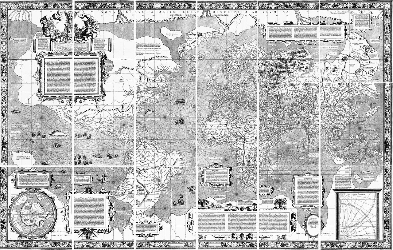
Era: Age of Discovery & Imperial·Cartographer: Gerardus Mercator (Gerhard Kremer)·Year: 1569·Public Domain
Mercator’s Nova et Aucta Orbis Terrae Descriptio (1569)
"The foundational marine navigation chart where lines of constant compass bearing are straight lines"
Mercator formulated a breakthrough mathematical projection: by progressively spacing parallels of latitude toward the poles, every rhumb line (loxodrome) plotted across the ocean becomes a straight line.
Interactive Specimen Pan & ZoomAccession: G3200 1569 .M4
Orientation: North-Up
2,020 × 1,240 mm (18 wall sheets)
Gerardus Mercator (Gerhard Kremer)·1569·Basel University Library / Library of Congress
ZOOM: 100%Repository Archive
Notable Cartographic Signatures
- First implementation of conformal cylindrical math
- Rupes Nigra (magnetic black rock) placed at the North Pole
- Immense Terra Australis continent spanning the Antarctic
The Rhetorical & Ideological Argument
"A specialized navigational instrument designed to prevent shipwrecks, whose conformal fidelity ($h=k=\sec\phi$) created massive polar landmass inflation."
Explicit Features
- First implementation of conformal cylindrical math
- Rupes Nigra (magnetic black rock) placed at the North Pole
- Immense Terra Australis continent spanning the Antarctic
Intentional Omissions
- Equal-area proportionality; high-latitude lands are inflated exponentially
Physical Specimen & Geodesy
Projection:
Conformal Cylindrical (Mercator Projection)
Orientation Axis:
North-Up
Physical Medium:
18 copperplate engraved printed sheets
Original Physical Dimensions:
2,020 × 1,240 mm (18 wall sheets)
Custodial Repository:
Basel University Library / Library of Congress
Accession: G3200 1569 .M4
Interdisciplinary Context & Connections
MorphologiumFORMULATES
Conformal Riemannian Metric Transformation
JuralogiumGOVERNS
Maritime Navigation Standards
Academic Provenance: Mercator, G. (1569)