Return to Map Specimen Database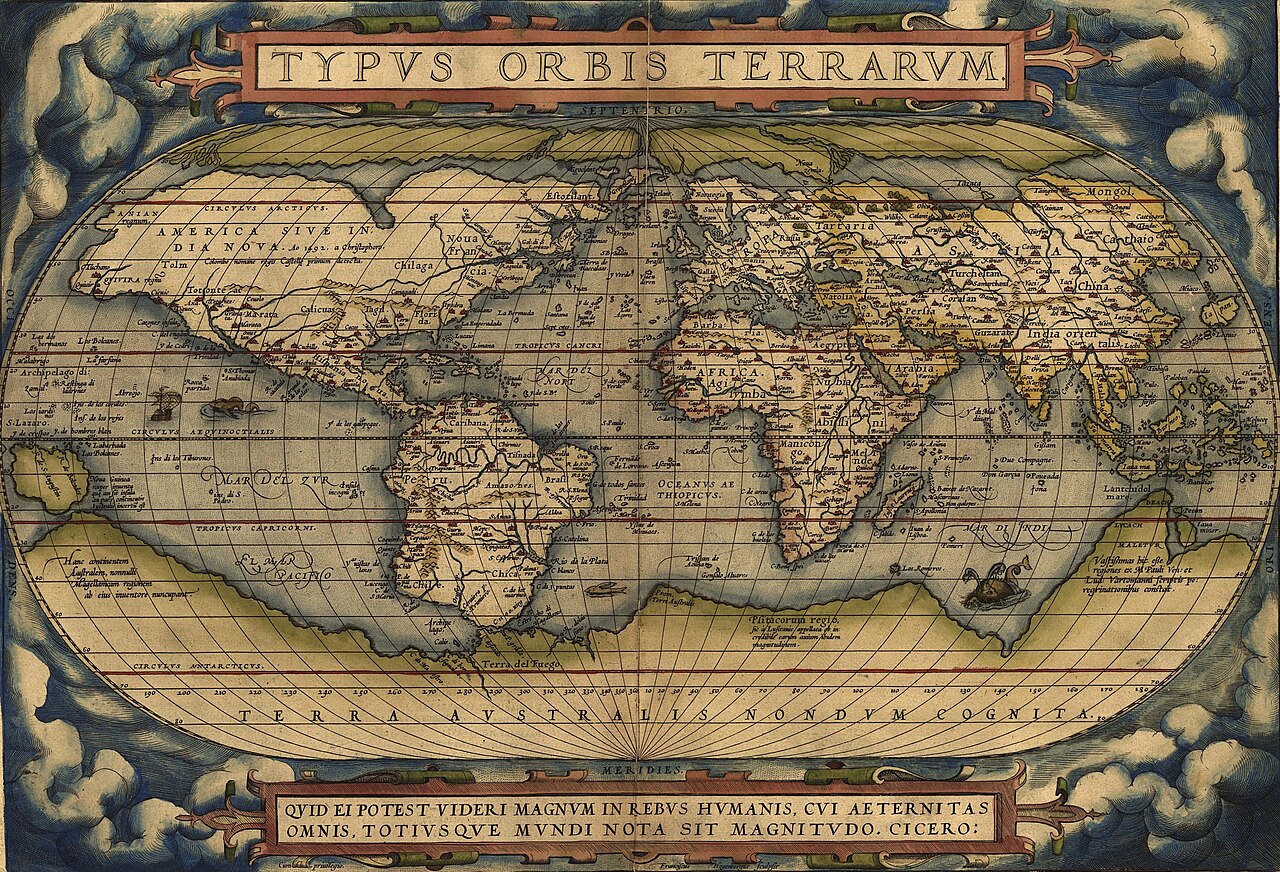
Era: Age of Discovery & Imperial·Cartographer: Abraham Ortelius·Year: 1570·Public Domain
Ortelius’s Theatrum Orbis Terrarum (1570)
"The world's first modern commercial atlas, standardizing global geographic knowledge"
Published in Antwerp on May 20, 1570, Ortelius's *Theatre of the World* contained 70 maps engraved in a uniform format and scale, including the first catalog of 87 cartographers (*Catalogus Auctorum*).
Interactive Specimen Pan & ZoomAccession: Rumsey Collection No. 5185.000
Orientation: North-Up
490 × 330 mm (folio atlas)
Abraham Ortelius·1570·David Rumsey Historical Map Collection
ZOOM: 100%Repository Archive
Notable Cartographic Signatures
- Uniform book dimensions and standardized visual design across all maps
- Noted that continental shapes fit together like puzzle pieces (first hint of continental drift)
- Lavish decorative sea monsters, galleons, and classical cartouches
The Rhetorical & Ideological Argument
"Geography is 'the eye of history' (historiae oculus): a unified commercial book format that allowed European elites to visually comprehend the expanding planetary empire."
Explicit Features
- Uniform book dimensions and standardized visual design across all maps
- Noted that continental shapes fit together like puzzle pieces (first hint of continental drift)
- Lavish decorative sea monsters, galleons, and classical cartouches
Intentional Omissions
- Accurate coastlines of Australia and Antarctica
Physical Specimen & Geodesy
Projection:
Oval Pseudocylindrical / Modified Mollweide Precursor
Orientation Axis:
North-Up
Physical Medium:
Hand-colored copperplate engraving on rag paper
Original Physical Dimensions:
490 × 330 mm (folio atlas)
Custodial Repository:
David Rumsey Historical Map Collection
Accession: Rumsey Collection No. 5185.000
Interdisciplinary Context & Connections
ChromologiumDEFINES
Renaissance Flemish Engraving Palettes
NarratologiumCREATES
The Commercial Atlas as Master Narrative
Academic Provenance: Ortelius, A. (1570)