Return to Map Specimen Database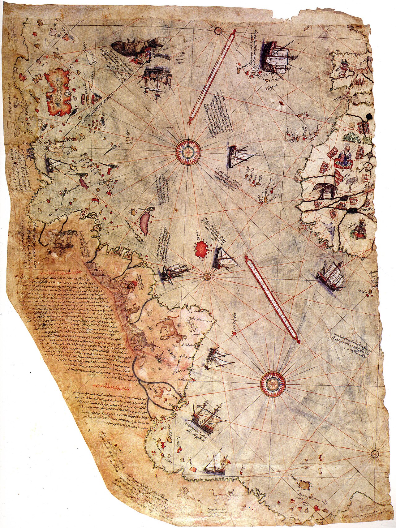
Era: Age of Discovery & Imperial·Cartographer: Hacı Ahmed Muhiddin Piri (Piri Reis)·Year: 1513·Public Domain
Piri Reis Map (1513)
"Ottoman naval portolan chart preserving Columbus’s lost Caribbean surveys and South American coastlines"
Drawn by Ottoman admiral Piri Reis in Gallipoli, this surviving third of a world map synthesized Portuguese charts, Islamic maritime lore, and a captured map drawn by Christopher Columbus himself.
Interactive Specimen Pan & ZoomAccession: TSMK No. 1633
Orientation: North-Up
900 × 630 mm (surviving fragment)
Hacı Ahmed Muhiddin Piri (Piri Reis)·1513·Topkapi Palace Museum, Istanbul
ZOOM: 100%Repository Archive
Notable Cartographic Signatures
- Accurate depiction of the Andes and South American rivers (Amazon, Rio de la Plata)
- Extensive Ottoman Turkish text inscriptions detailing indigenous fauna and Columbus's expeditions
- Rhumb line intersections centered on Atlantic ocean compass nodes
The Rhetorical & Ideological Argument
"A demonstration of Ottoman naval reconnaissance parity: proving the Sultanate possessed high-accuracy spatial intelligence on Spanish and Portuguese oceanic discoveries."
Explicit Features
- Accurate depiction of the Andes and South American rivers (Amazon, Rio de la Plata)
- Extensive Ottoman Turkish text inscriptions detailing indigenous fauna and Columbus's expeditions
- Rhumb line intersections centered on Atlantic ocean compass nodes
Intentional Omissions
- The missing two-thirds of the map covering Europe, Asia, and Africa
Physical Specimen & Geodesy
Projection:
Portolan Azimuthal Rhumb Network
Orientation Axis:
North-Up
Physical Medium:
Camel/Gazelle hide vellum with mineral pigments
Original Physical Dimensions:
900 × 630 mm (surviving fragment)
Custodial Repository:
Topkapi Palace Museum, Istanbul
Accession: TSMK No. 1633
Interdisciplinary Context & Connections
VeridianumOPERATES_AS
Naval Intelligence Surveillance
LunologiumCALCULATES_BY
Portolan Azimuthal Astrolabe Calculations
Academic Provenance: Piri Reis (1513)