Return to Map Specimen Database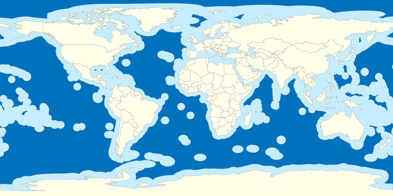
Era: Modern & Planetary·Cartographer: United Nations Division for Ocean Affairs and the Law of the Sea (DOALOS)·Year: 1982·Open Access / Educational
UNCLOS Global Maritime Delimitation & EEZ Chart (1982)
"The legal chart partitioning 38% of the world's oceans into sovereign Exclusive Economic Zones"
Mapping the maritime zones codified under the 1982 Law of the Sea treaty: Territorial Sea (12 nm), Contiguous Zone (24 nm), and Exclusive Economic Zone (200 nm), enclosing 138 million km² of ocean.
Interactive Specimen Pan & ZoomAccession: UN Cartography Map No. 4153
Orientation: North-Up
1,200 × 800 mm
United Nations Division for Ocean Affairs and the Law of the Sea (DOALOS)·1982·United Nations Cartographic Section, New York
ZOOM: 100%Repository Archive
Notable Cartographic Signatures
- 200-nautical-mile EEZ boundaries surrounding all coastal states and remote islands
- High Seas ('The Area') designated as the common heritage of mankind
- Median baseline delimitation lines resolving bilateral maritime disputes
The Rhetorical & Ideological Argument
"The oceans are no longer a free international commons (*mare liberum*); coastal states possess sovereign economic rights over marine resources and continental shelf minerals."
Explicit Features
- 200-nautical-mile EEZ boundaries surrounding all coastal states and remote islands
- High Seas ('The Area') designated as the common heritage of mankind
- Median baseline delimitation lines resolving bilateral maritime disputes
Intentional Omissions
- Overlapping bilateral claims in actively disputed waters (e.g. South China Sea)
Physical Specimen & Geodesy
Projection:
Winkel Tripel Projection
Orientation Axis:
North-Up
Physical Medium:
Color GIS vector thematic chart
Original Physical Dimensions:
1,200 × 800 mm
Custodial Repository:
United Nations Cartographic Section, New York
Accession: UN Cartography Map No. 4153
Interdisciplinary Context & Connections
JuralogiumENFORCES
UNCLOS Maritime Sovereign Jurisdictions
VeridianumMONITORS
Maritime Exclusive Economic Zone Conflict Radar
Academic Provenance: United Nations DOALOS (1982)