Return to Map Specimen Database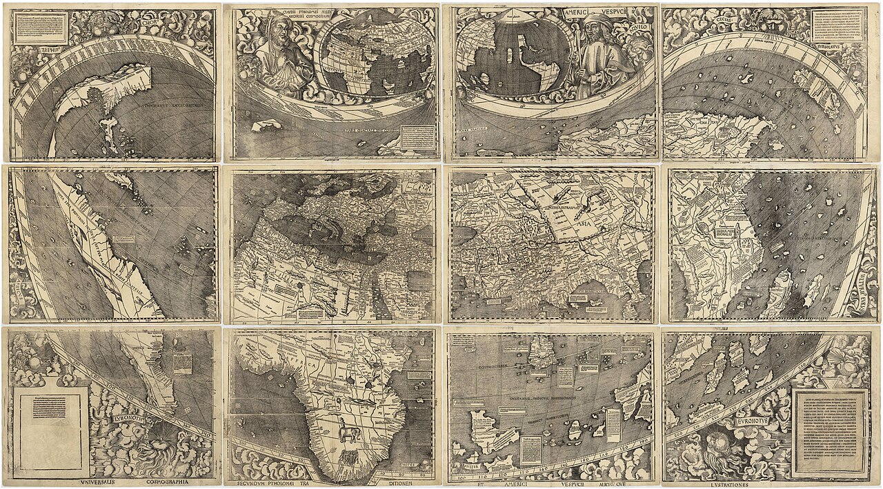
Era: Age of Discovery & Imperial·Cartographer: Martin Waldseemüller & Matthias Ringmann·Year: 1507·US Government Public Domain
Waldseemüller World Map (Universalis Cosmographia, 1507)
"The 'Birth Certificate of America': The first printed map to apply the name 'AMERICA'"
Created in Saint-Dié-des-Vosges, France, this monumental 12-panel wall map is the only surviving copy of 1,000 printed. It was the first map to depict the Western Hemisphere separated from Asia by a distinct Pacific Ocean.
Interactive Specimen Pan & ZoomAccession: G3200 1507 .W3
Orientation: North-Up
2,320 × 1,280 mm (12 woodcut sheets)
Martin Waldseemüller & Matthias Ringmann·1507·Library of Congress, Washington D.C.
ZOOM: 100%Repository Archive
Notable Cartographic Signatures
- The word 'AMERICA' printed across South America
- Inset portrait of Amerigo Vespucci alongside Ptolemy
- Depiction of the Pacific Ocean six years before Balboa sighted it in 1513
The Rhetorical & Ideological Argument
"Honors Florentine navigator Amerigo Vespucci by christening the newly recognized fourth part of the world 'America' (the feminine form of Amerigo, matching Europa and Asia)."
Explicit Features
- The word 'AMERICA' printed across South America
- Inset portrait of Amerigo Vespucci alongside Ptolemy
- Depiction of the Pacific Ocean six years before Balboa sighted it in 1513
Intentional Omissions
- Detailed North American interior (depicted as a slender coastal ribbon)
Physical Specimen & Geodesy
Projection:
Ptolemy's Second Modified Pseudoconic Projection
Orientation Axis:
North-Up
Physical Medium:
12 woodblock printed sheets on rag paper
Original Physical Dimensions:
2,320 × 1,280 mm (12 woodcut sheets)
Custodial Repository:
Library of Congress, Washington D.C.
Accession: G3200 1507 .W3
Interdisciplinary Context & Connections
NarratologiumFOUNDS
Toponymic Inscription of a Continent
JuralogiumVALIDATES
Discovery Doctrine Territorial Title
Academic Provenance: Waldseemüller, M., & Ringmann, M. (1507)