Return to Map Specimen Database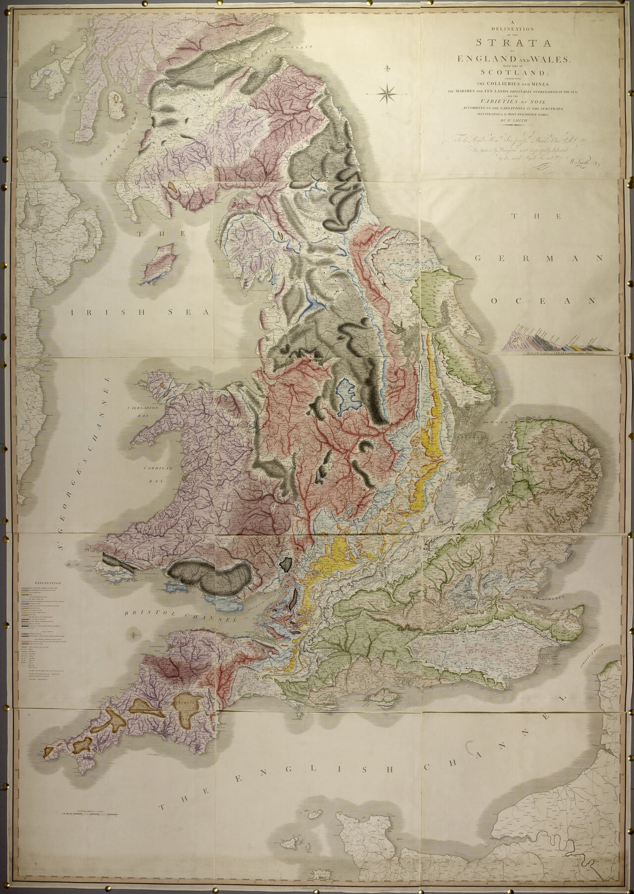
Era: Thematic & Scientific Revolution·Cartographer: William Smith ('Strata Smith')·Year: 1815·Public Domain
William Smith’s Geological Map of England and Wales (1815)
"'The Map that Changed the World': The first nationwide geological strata map"
Self-taught canal surveyor William Smith proved that geological rock layers can be identified and correlated over vast distances by their fossil contents. He hand-painted 15 giant sheets to create the world's first national geological map.
Interactive Specimen Pan & ZoomAccession: Rumsey Collection No. 0081.000
Orientation: North-Up
2,600 × 1,800 mm (15 sheets)
William Smith ('Strata Smith')·1815·Geological Society of London / David Rumsey Collection
ZOOM: 100%Repository Archive
Notable Cartographic Signatures
- First systematic use of colored thematic shading to depict underground rock strata
- Darker color shading along the base of each stratum layer showing vertical tilt
- Identified fossil index sequences matching rock ages
The Rhetorical & Ideological Argument
"Beneath the visible surface of property borders and political kingdoms lies a three-dimensional vertical history of the Earth, organized in orderly strata and rich in industrial coal and iron."
Explicit Features
- First systematic use of colored thematic shading to depict underground rock strata
- Darker color shading along the base of each stratum layer showing vertical tilt
- Identified fossil index sequences matching rock ages
Intentional Omissions
- Pre-Cambrian metamorphic basement rocks (labeled vaguely as 'Killas')
Physical Specimen & Geodesy
Projection:
Cassini-Soldner Projection
Orientation Axis:
North-Up
Physical Medium:
Hand-colored copperplate engraving with watercolor stratigraphic tints
Original Physical Dimensions:
2,600 × 1,800 mm (15 sheets)
Custodial Repository:
Geological Society of London / David Rumsey Collection
Accession: Rumsey Collection No. 0081.000
Interdisciplinary Context & Connections
ChromologiumESTABLISHES
Stratigraphic Color Coding Standards
MorphologiumFOUNDS
3D Subterranean Geological Fault Meshes
Academic Provenance: Smith, W. (1815)